
When fire department personnel are racing the clock to respond to an emergency, having real-time location data and insights can make all the difference. First Arriving Dashboards provide fire departments with a powerful tool for mapping everything from routes, to resources, to hazards, and more.
By leveraging these mapping capabilities, fire departments can now make more informed decisions than ever before, with enhanced situational awareness and increased efficiency in collaboration and allocation of resources.
For Roanoke Fire-EMS in Virginia, mapping was the top feature that sold the department on implementing dashboards, along with the system’s ability to integrate their staffing assignments, said Deputy Chief Andy Foley.
“That’s very important on any kind of fire scene,” he said, “as well as, again, the address coming up with the mapping, the call type, and a brief description of what the call is.”
Here are some of the ways that fire departments can use the power of mapping to enhance their emergency response.
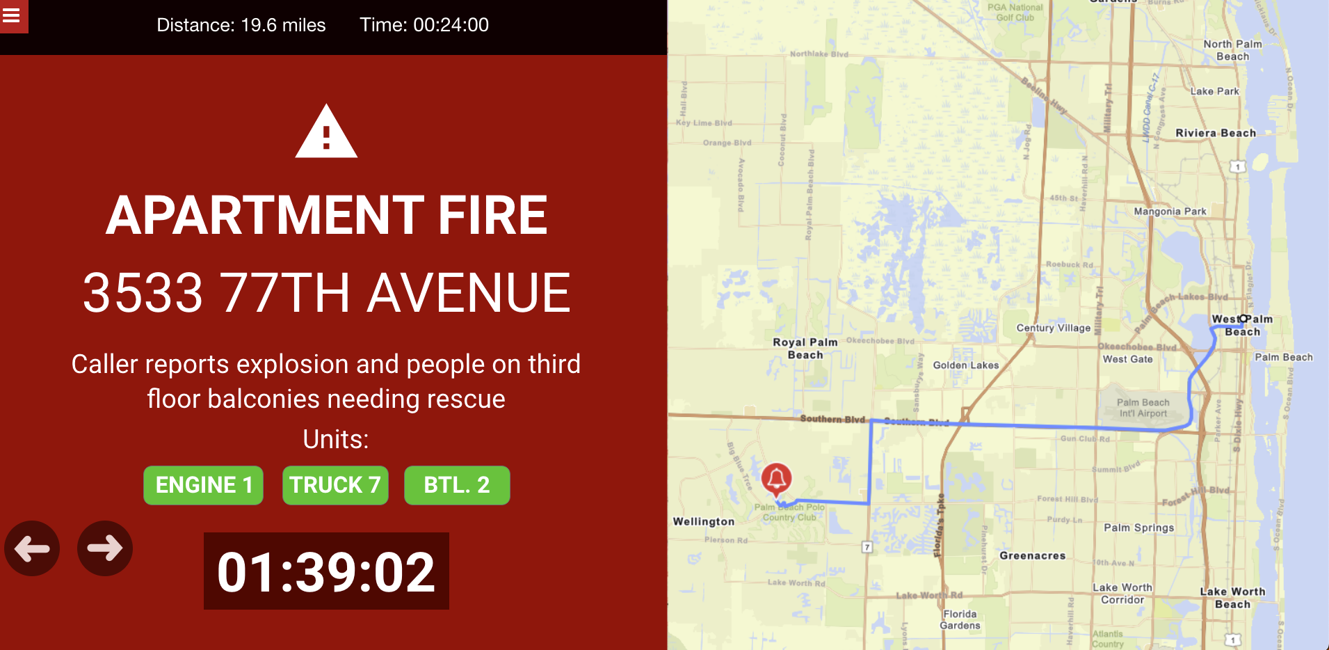
Incident Location and Proximity:
The primary purpose of mapping is to allow fire departments to quickly locate incidents on a map, and to better assess their distance, estimated time to arrival, and their best routes based on traffic, weather, road closures, etc. Mapping also provides the ability to visualize the location for quicker identification upon arrival, better understanding of the scene, and better decision-making for getting there, enhancing response times and ultimately saving lives.
Resource Allocation and Management:
With mapping, fire departments can opt to show resources around an incident, both stationary and mobile. Stationary resources can include fire hydrants, fire stations, hospitals, and more. But most importantly, mapping capabilities on First Arriving Dashboards provide fire departments with the ability to track and manage personnel and apparatus. This enhances safety, efficiency, and aids in coordination with other agencies, ensuring that resources are deployed strategically and collaboratively.
Environmental and Risk Assessment:
Geo-data available on First Arriving Dashboards can help fire departments evaluate environmental factors and assess potential risks associated with incident locations. These can include everything from weather concerns, to terrain, to traffic, to gas lines, etc. With this knowledge, fire departments can develop more effective response strategies. For example, for a hazardous materials incident, mapping capabilities allow fire departments to identify the risk zones and plan accordingly.
Historical Incident Analysis:
Mapping capabilities on First Arriving Dashboards can provide fire departments with insights and trends from historical incident data. By visualizing past incidents on maps, fire departments can identify patterns and understand trends that may influence their incident response strategies. The ability to filter and analyze data based on time, location, and incident type allows fire departments to develop data-driven strategies, which can improve their operational effectiveness.
Multi-Agency Response Coordination:
By integrating maps and geo-data from multiple agencies, fire departments can visualize an incident’s entire landscape and scope of resources, and better understand the operational challenges. This visual collaboration allows for faster and more effective resource allocation, minimizes duplication of effort, and enables overall better incident management.
As public safety challenges continue to grow and evolve, so does the need for incident data to enable the most effective response. First Arriving Dashboards’ mapping capabilities provide fire departments with valuable insights and the ability to make data-driven decisions in their emergency response operations. From resource tracking to risk assessment, and multi-agency collaboration, mapping offers endless opportunities to enhance operational effectiveness. By harnessing the power of mapping, fire departments can make their communities safer, their responses safer, and provide better outcomes for the people they serve.