
Key Features
|
Multiple Input Methods |
Accepts standard CAD feed formats, partner APIs (Active911, eDispatches, Bryx, etc.), or parsed emails/text messages. |
|
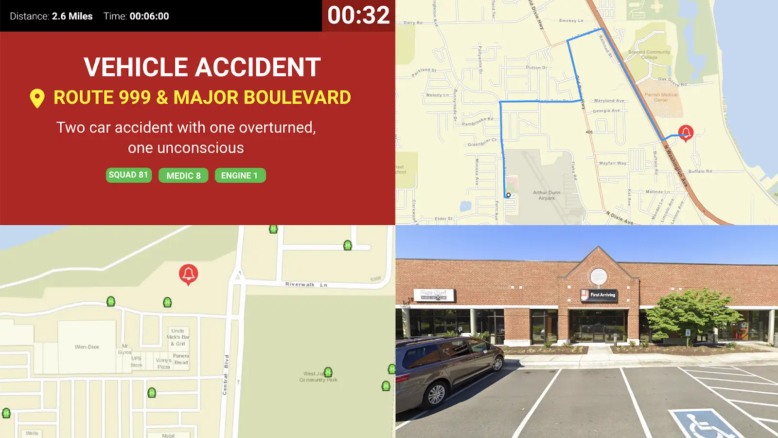
Rich Alert Content |
Transmits incident details, location coordinates, mapping, unit / personnel assignments, and more. |
|
Live Mapping |
Supports Google Maps and ESRI layers for real‑time visualization. |
|
Resource Monitoring |
Displays unit availability, AVL positions, hydrant locations, hospital status, and other CAD metrics. |
|
Internet‑Based Delivery |
Works anywhere with an internet connection—ideal for mobile or station dashboards. |
|
Configurable Filtering |
Route specific incident types or units to selected devices or stations. |
First Arriving’s Integration With CAD / Dispatch Feeds Include:
For call alerting and other data from your CAD, we can feed in a variety of ways, including:
- Feed from CAD via a variety of standard formats
- Parsed notifications via email, text and other messaging platforms
- Data from our various integration partners including Active911, eDispatches, Bryx, iSpyFire, FirstWatch, ER and Locution
- Mapping options including Google Maps and ESRI
We do not require integration to access your CAD directly, but if that is an option it can always be explored.
Please keep in mind we should always be considered secondary alerting, we do NOT replace your CAD or dispatch. Our solution is Internet-based and relies on your CAD/dispatch service to send data.
What We Can Show:
-
Data can include a wide array of information for both emergency alerting and non-emergency information, depending on the feed and content available to be provided to us, including:
- Real-time notification of alerts or calls of varying type, including details, location, mapping, unit and/or personnel information and more.
- Alerts can include incidents, department wide notifications, emergency updates and more
- Units available, AVL feeds, units in and out of service, hydrants and other key metrics from CAD
- Hospital or other facility/resource statuses.
- More — If you’ve got the data, we can likely make it work.
Email Parser Options:
Don’t have a direct feed or CAD access, or utilize one of our partners’ services? We can ingest an email or other messaging to display your alerting or call data. In those cases, we typically need:
- We’ll provide you with an email address or other messaging location to send us the data from your dispatch center or other appropriate party.
- The body of the email should include the key information of the alert
- For incidents, the body will typically include the nature of the call, location, unit identifiers to filter which devices get which alerts (especially across multiple stations)
Expanded Partners:
The following partners provide enhanced data to use from CAD, please click the links for full details:
- Active911
- Bryx
- Emergency Reporting
- ISpyFire
- Locution
- Motorola Solutions Flex (formerly Spillman)
- Nexgen CAD
- Southern Software


